The world is beautiful and majestic when seen from the ground level, but words cannot explain how amazing it looks from above.
Once it was just an astronauts’ privilege, but nowadays everyone can have access at the satellite view of our planet just with the click of a mouse.
We recently stumbled upon “The Daily Overview”, a very interesting project, that provides each day a new satellite image of the Earth.
The images provided by “The Daily Overview” are some of the most beautiful satellite images we’ve ever seen, and many of them could be easily framed and hung on the wall.
The service they use to collect the images is Apple Maps, which is powered by Digital Globe, and below you can see our favorite pick out of the project.
If you want to take a look at the entire “The Daily Overview” project, check out their official website here.
If you like this post, share it with your friends on Facebook!
[ssba]
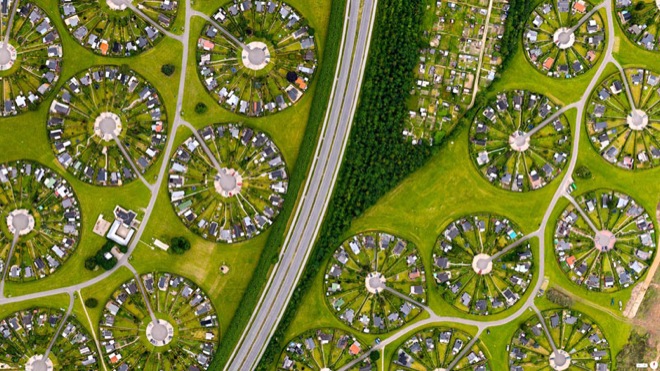
1. Brøndby Haveby, Denmark
55°38’12.836031″N, 12°23’58.386726″E
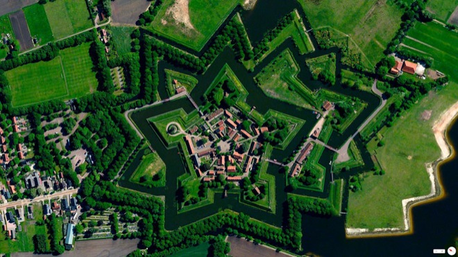
2. Bourtange – Vlagtwedde, Netherlands
53.0066°N 7.1920°E
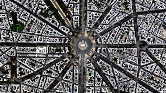
3. Arc de Triomphe, Paris, France
48.8738°N 2.2950°E
4. Bayshore Route, Daikoku Junction, Yokohama, Japan
35° 27.771′, 139° 40.829′

5. Nardò Ring, Nardò, Italy
40°19′38″N 17°49′34″E
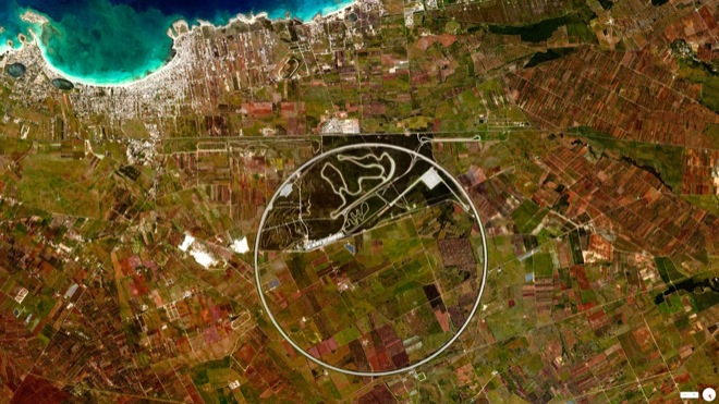
The Nardò Ring is a high speed, 7.8 mile long, circular test track in Nardò, Italy. Each of the ring’s four lanes has a determined “neutral speed” and is banked in such a manner that one can drive as if the road were straight. (via)
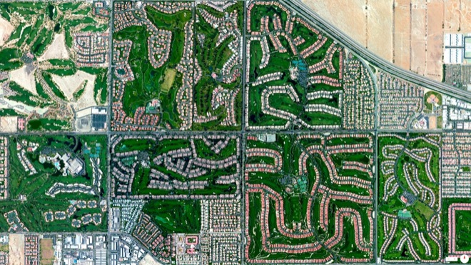
6. Golf Courses, Palm Desert California
33°43′32″N 116°22′10″W
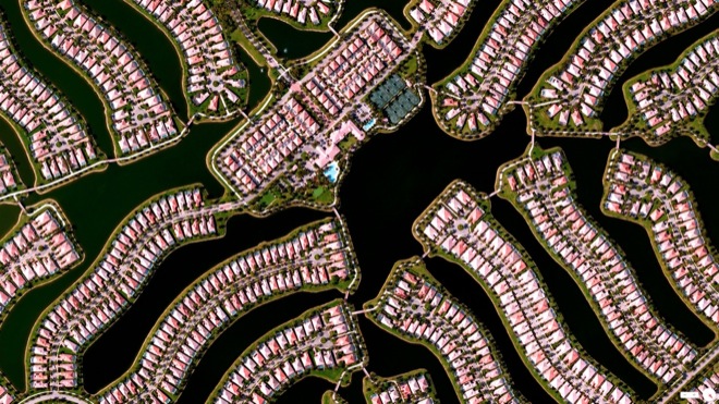
7. Residential development, Naples, Florida, USA
26.250632, -81.711302
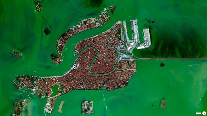
8. Venice, Italy
45°26’15″N 12°20’9″E