15 amazing pictures of Earth photographed from space

Share this post on FB:
Namib Desert

Nowadays we have access to a load of images taken by satellites. We can look at them in Google Maps, Google Earth and many other online cartography services. The NASA itself used to publish a picture a day before the service was closed. Luckily the European Space Agency continues to publish awesome photos taken by its satellites (archive here) to delight our eyes letting us see sceneries we probably will never be able to see in real life (at least if you are not an astronaut).

Today we show you a selection of these larger than life images that you probably will never see in most famous online maps services. We are sure you will love them.

All the images are property of European Space Agency.

If you enjoyed this post, don’t be selfish, share it with your friends via Facebook or Twitter (links are in the right sidebar).

Peruvian Landscape
Peruvian Landscape
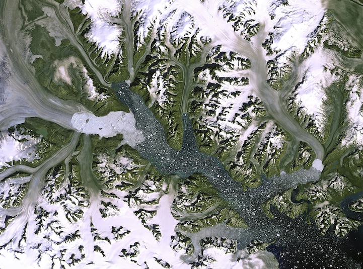
Kangerdlugssuaq glacier, Greenland
Northwestern Crete, compilation of images
Swirling cloud art in the Atlantic Ocean
The Island of Elba, Italy, compilation of images
Clearwater Lakes, Canada
Rainforest river, Brazil, compilation of images
Plentiful plankton
Plentiful plankton
Ganges’ dazzling delta
Libya's Al Jawf oasis
Libya’s Al Jawf oasis
Mississippi River Delta
Virunga Mountains, compilation of images
Namib Desert
Namib Desert
Scandinavian snows
Scandinavian snows

Agricultural crops in Aragon and Catalonia

(via)